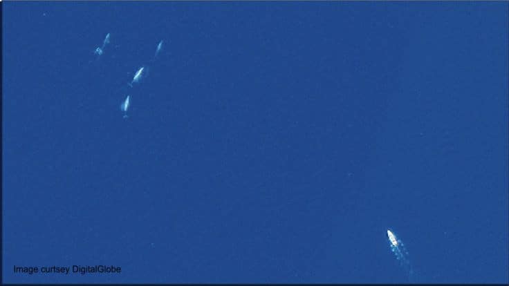
Analysing satellite images can be difficult, with pictures often blurry and the whales themselves incredibly hard to see. That’s where scientists are enlisting the help of Artificial Intelligence (AI).
Technology has been used in conservation efforts to help count the number of a specific species for a while now, however, something AI can’t yet do is differentiate between different species. According to BAS, for this to happen, AI systems need a large “open-source library” of images with descriptions of the whale species.
To help with this, BAS scientists Dr Hannah Cubyanes and Peter Fretwell have released 633 annotated images of whales. These images were collected over an area of 6,300 km2.

“Satellite imagery can be a powerful and complementary tool to study whales; however, we need AI systems to efficiently detect whales in the imagery.
“For these AI systems to produce accurate results, they need many hundreds of examples of whales in satellite imagery to learn what whales look like from space. Our publicly available datasets will contribute to training such AI models and encourage others to share their datasets.”
BAS has high hopes for this initiative which is a part of the Wildlife from Space project.
“Many threats to whales across the world persist and some species are classified as critically endangered.
“It is hoped that this will support the development of next generation artificial intelligence systems that will aid research and conservation of whale species that are threatened by ship strikes, pollution, entanglement, and disease.”


